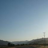
Today's New York Times has a very interesting article about China Lake Petroglyphs. China Lake is a military base adjacent Death Valley in the Mojave Desert. Now I have another good reason to return to California and explore this wonder!
Rock Art Redefines 'Ancient'
Friday, December 18, 2009
Sunday, December 6, 2009
Travels with Charley in Search of America
For those who like to read books about travel, I recommend John Steinbeck's "Travels with Charley in Search of America." I read this after returning from my trip and was amazed at the number of similar thoughts I had while traveling.
The book is about his three month journey across America with his dog Charley in 1960. He had a camper made to order for his trip and took a different route but left right after Labor Day, as I did.
Here's a link to Amazon for Travels with Charley.
The book is about his three month journey across America with his dog Charley in 1960. He had a camper made to order for his trip and took a different route but left right after Labor Day, as I did.
Here's a link to Amazon for Travels with Charley.
Saturday, December 5, 2009
Pittston, PA to Home
 |
| Day 47 Photo Album |
October 19, 2009
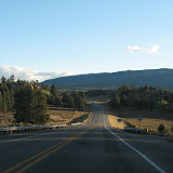
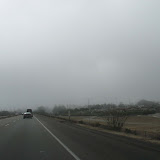
The motel in Pittston was the pits. I couldn’t wait to leave in the morning, so I set out at sunrise, set to beat the rush hour traffic in Boston.
Driving in the morning is wonderful. Light is breaking across the land with sweetness and promise. The night’s remains linger in the shadows as dew or frost. Fog rises from the valley floor and looks for a new form before your eyes. This fog has followed me across the continent and calls me back to another coast, I hear its voice and listen. Always turning over the places I set foot or wheel in. There is so much to think about now.
But the traffic pounded out most thoughts during the day. Before I knew it, I was back in the flow of people elbowing their way around the lanes.
I stopped in Danbury, Connecticut around 10 a.m. to have a longer rest, leaning back in the car. After a while, a man tried to get into the car, thinking it was his. Good thing I locked it! He was very sorry, it seems he had a rental car and got confused. Pretty funny actually. It was time to go anyway.
The last thing I wanted was to sit in traffic along I-95, so I pushed really hard to get beyond it by 2 p.m. My eyes were weary, my mind was trying to hold on to those lovely days in the desert, or corn fields, or anywhere other than a city. I’ve concluded that people are all the same everywhere, when they get too condensed, they tend to behave badly. Why this is, I have no idea. I have a theory that it just isn’t natural for so many people to be so close together.
At 1:52 p.m. while crossing Route 2, I had gone 9,000 miles. I got home at 2:30 p.m. with a final marker of 9,033.9.
It was very odd to park my car in my spot, walk inside, and actually be home. Even now, 5 hours later, something seems odd. Oh, that’s me.
The most remarkable aspect of my journey was the response from my family and friends who followed the journey through my blog, by phone, and during visits. They surprised me with their enjoyment and wonder at what I was doing, their appreciation of my daily reports, and the completely positive support for my choices.
I’m certain this won’t be the last journey I make!
Friday, December 4, 2009
Uniontown to Pittston, Pennsylvania
 |
| Day 46 Photo Album |
October 18, 2009
My decision to stay in the Blue Mountain Motel was a good one. It was tiny but cozy and personal. I don’t really like hotels or motels. The bedspread was a pure white quilt, the sheets were flowered, and there were four pillows! The walls had framed work that seemed personal to the owner. There are only eight units and the owners’ house has a bell to ring for service. The screen doors are all battered and the place needs work, but somehow all this combines to make a psychologically satisfying stay.
I was off just after daylight, which is 7:30 a.m. in this geographic location. It was 38 degrees when I departed and still cloudy. Not many people out and about so it seemed as though I was wandering through ghost towns as I made my way up Route 119. I noticed that in Uniontown, a person named Palumbo was running for city council. As I was zig-zagging through detours and alternate route signs I didn’t stop to take many pictures. I believe this is a coal mining area and though there are some weary areas there was still a feeling of stable communities. All assumptions based on nothing but looks and feelings.
The route was filled with farm country, small towns, and gorgeous countryside. The leaves were perfect. I’ve been to many places along I-76 back in my days of abode in Philadelphia, so I wanted to take this western, northern route to I-80 for a change of scenery.
As I didn’t have any internet access last night I had to watch the weather channel and their dire predictions were of snow and rain all day all across Pennsylvania. My forecast was for a sunny day because I really needed it. About an hour into my drive the sun began to peek out of the clouds and I shouted in my sister’s ear to declare victory (via phone, of course). It took another hour or so for the damn clouds to clear out and become lovely poofs to look at against deep blue sky. Deep Blue Sky! That’s another thing I haven’t seen for 10 days!
Without realizing it, Punxsutawny was on my path. I felt a bit like a groundhog today, coming out of my cloud burrow to see my shadow. Though I must say, I have observed shadows under cars on the highway even under heavy clouds. One of the bizarre things my mind notices. I stopped for gas at one of the chains in Pennsylvania called Sheetz. Pennsylvania has some of the funnest names for things and places.
I was soon on the interstate and began to notice that they are the fastest drivers I’ve encountered so far. I stick to the speed limit, which was 65. Everybody was zooming around me; fine with me, go ahead. But when there is only one lane, like around Wilkes-Barre where I tried to find a motel, they are dangerous. Passing in no-passing zones, riding my bumper, nutty.
The landscape of mountains was full of color and after a while they widen and become longer. I could see mesas stretching out and jutting up instead of wearing down. Or all the smaller waves of hills from West Virginia melding together and forming a long chain. What if you combine the mesas of New Mexico with the lushness of the east?
Clearly it is time to be home and start creating my own landscapes. I’m 333 miles from home now, having landed in Pittston, Pennsylvania. I had hoped to stop at my friend’s house in Connecticut on the way, but she has other obligations tomorrow, so I’m on a straight line home.
At this point I have transitioned from not wanting to go home to looking forward to getting there. After that, a whole lot of thinking and creating will begin.
Thursday, December 3, 2009
North through West Virginia
 |
| Day 45 Photo Album |
October 17, 2009
The extra day at rest was uneventful, at least to the public. Internally, when I stay still the past surges up and unexpected connections with my ancient past collide with future events. The weather continued to be stubbornly thick, cold, and rainy. My cabin was nice and warm and all my laundry all clean.
So I rose early and looked forward to moving again. I’ll say this for the weather: at least it DID something today. Instead of unmoving heavy clouds, they moved about, rained, cleared ever so slightly, and drug fog along the ground. Indeed, by the time I got to Uniontown, Pennsylvania, the fog was so thick it was hard to see.
Energy was aggressively hyper along I-79 as there is a college football game between two rival West Virginia teams in Morgantown. I shall refrain from exaggerating the number of cars with flags, emblems and whatnot on the road. It seemed like 80% of them, so I’ll say 50%. They were at all the rest stops, hopping like over-caffeinated Wall Street brokers to do their business and get back on the road. More than once I passed a car stopped on the side of the road to pick up their little flags that had blown off their cars.
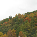
I thoroughly enjoyed my drive. The trees were perfectly balanced between all shades of green, yellow and orange. The road weaves splendidly among the waves of hills. To me the hills here seem smaller, more numerous and more pointed. I imagined myself within a tree ocean, riding the troughs of waves. Sometimes the trees give way to a bit of rich green grass and a house tucked into the edge. The highway was remarkably free of billboards.
I intended to turn off at a Route that would take me directly to Uniontown, but there was no forewarning and I missed it. So I had to go a bit further and backtrack. I was headed for Pennsylvania Route 40 and it was great to be on a two lane road for the last leg of the trip.
There is a Frank Lloyd Wright designed house right near here, but I didn’t check it out today as the fog was so thick and the temperature was dropping to freezing. So I found a hide-away motel called Blue Mountain and tucked myself in at 3 pm. No internet connection, but I watched the Weather Channel and my intended route for tomorrow is right in the path of the Nor’easter spreading its wings across all of the northeast. Still no sun predicted until Monday when I hope to make my final journey home.
Wednesday, December 2, 2009
Mt. Vernon to the End of Kentucky
 |
| Day 43 Photo Album |
October 15, 2009
I should have been more specific about the state when I speak of cities; it seems that there are duplicates. As I began my day I did a double take over the border in Indiana: signs for Mt. Vernon and Boonville (places I had driven through in Illinois) were posted. Hey, am I going the wrong direction?
This happened at the border of Kansas and Illinois too. I saw signs for O’Fallon before getting to Kansas City (which is duplicated right next to itself as well) then as I headed out of Indepedence I saw another sign for O’Fallon in Missouri, just about the same distance from Kansas City as the other one.
This makes me wonder if borders cause a mirroring affect.
My stay was in Mt Vernon, Illinois. The usual heavy cloud cover stayed with me all day. A bit of rain again, not serious. The corn is dried out, but apparently not dried out enough. My father says that to harvest corn for grain it needs to get to the optimum moisture content so that it stores well. I believe this is between 15% and 16%. There seemed to be a lot of orange and yellow in the landscape of crops which may be soybeans. It was beautiful to me. Folds of gentle slopes dipping and weaving in and out of each other amidst stands of trees and farm buildings, their colors changing from yellow to orange to green. Then a vast open space of corn with a line of distant trees to hold it in the frame.
Oil pumps are in the fields of Illinois and Indiana as well. Just one or two here and there. Right in the middle of the crops. This fascinates me.
Then the highway will be enclosed by a tunnel of trees. It was fun.
Indiana billboards informed me that I could visit the Marengo Caves which are a National Landmark. I wondered why I would do such a thing on such an overcast day. But when I stopped for a rest at the exit for Marengo I changed my mind and ventured ten miles north off the highway to walk underground. After all, I’ve never been in a cave and I could use a walk.
This was a very weird experience. The tour covers over a mile of the cave. Though they are careful about people touching things and leaving trash behind, it hasn’t always been that way. When the caves were first discovered they were used for all kinds of events: concerts, plays, square dancing, boy scout sleepovers, and more. The kids still get to do quite a lot more than the tour, which is pretty exciting for them.
Some of the spaces are small enough you have to duck, but for the most part it is a passageway that leads into multiple large areas (where all the fun used to transpire). I was enjoying the weirdness of it and taking photos like a nut, hoping something would turn out.
When I came outside I suddenly found I could breathe much freer. It hadn’t occurred to me until then that I was feeling a bit tense down there. Especially from the point where she showed us how the ceiling falls down every once in a while to create various layers. Oh yes, and she was told it was safer to be underground during an earthquake. I’m going to have to look into that assertion.
The clouds and dullness of the day seemed infinitely more cheerful for the remainder of the day.
Into Kentucky I started to see those beautiful green grasses and black fences. Didn’t see many white fences. What I really enjoyed was the way the hills were shaped and how the highway flowed in and out of them. The colors are still turning with just a few places where the trees are bare.
My energy was good so I drove on a bit after dark and found the KOA west of Ashland, Kentucky, right before the border of West Virginia. To my delighted surprise I found their cabins have bathrooms! What a lovely cabin I’ve got! So I’ve decided to stay a day here and rest up while the snow blows out of Pennsylvania.
The snow and rain are covering the entire northeast until Sunday or Monday. I’ll make for Morgantown, West Virginia, Saturday then get off the highway as I make my way north across the western part of Pennsylvania.
Tuesday, December 1, 2009
Independence to Mt. Vernon
 |
| Day 42 Photo Album |
October 14, 2009
On the edge of Kansas and Missouri I set out to cross new territory. It rained all night, not too hard. The rain was never very serious all day today, but the clouds are. So thick and heavy overhead. A seriously gray day.
Driving on the interstate in this state makes me want to just keep going and going until I get home. The realization that I’m nearly finished with my trip hovered like the clouds and acceptance that this direction may hold some interesting experiences, but it is still the winding down.
Trucks provide ample interest. I enjoy unusual loads and think about all the stuff moving from here to there constantly. I think about the lives of truckers and how they manage to keep moving and maintaining their lives.
At one rest stop in Missouri a couple had taken their horse out of the trailer and couldn’t get it back in. The horse just refused to go back, no matter how much they pulled and prodded. I took a picture from inside the car and it just focused on the raindrops on the window, but the image is interesting.
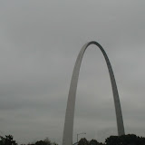
Driving through St. Louis was busy and although I could have stopped to see the arch, I felt like moving on. From the highway the beauty of the arch is crowded out by the billboards and a new thing that is like a moving picture in neon lights. These things should be outlawed.
Speaking of billboards, there is plenty of available space for advertisers along the route. Many of the billboards are begging for someone to advertise.
If you look at a map of Missouri you’ll see that all the state highways are letters and not numbers. That’s a twist. The land is lush and blanketed with trees. The hills are gentle and consistent. It looks a lot like the east coast.
The temperature never got above 48 degrees today. I think the high was around St. Louis. I knew I was in Illinois when the signs changed from a $10,000 fine for hitting a construction worker plus losing your license to a $10,000 fine and 14 years in prison. The land also flattened out and corn fields returned. I like Illinois. It feels good.
So I’ve settled down for the night at a Motel 6 alongside the highway. They are very cheap and not AAA approved, but clean and good enough. I don’t know how much more camping I’ll get to do if this cold keeps up.
I’m hoping for lots of leaf peeping the rest of the way. Most of the trees so far are beginning to turn with plenty of green still to make a very pleasant drive.
Monday, November 30, 2009
WaKeeney to Independence
 |
| Day 41 Photo Album |
October 13, 2009
I did some weather searching last night, all the way out to Pittsburgh. I’m in for cloudy skies and rain through the week. At least the temperature is above freezing.
So. Gotta make the best of what’s out there. Ready to be wet and sun-deprived.
The KOA in WaKeeney was the cleanest I’ve been in. Niagara Falls was good, but not as good as this one. That’s a super treat for all those things you do in the mornings that you don’t usually need to think about in your home.
All day long I saw signs for the OZ Museum and when it came to turn off, I was in the left lane. What a way to make a decision. It seemed like something I should investigate and take a break. That goes to show you that putting billboards up for 150 miles doesn’t necessarily get you business.
The rest stops along the highway leave quite a bit to be desired but they make up for it by having trash cans suspended above the ground. I just love this and the photo album for today has R2D2 and his friend posing. It looks like they swing forward but I didn’t give it a try. Perhaps there’s another reason.
Not far from Salina the hills start to roll and the land begins to have more trees. I was intrigued by the oil pumps in the middle of the fields. It certainly looked like the fields were for crops, but maybe not.
Describing what I'm seeing to my father over the telephone, he informed me that the maroon crops that resemble corn are milo. I like this crop. It’s still standing and as I looked out over miles of milo I’d see a rascal reaching higher than the rest with wild arms waving.
Rolling hills became serious around the Flint Hills. Rocks! Flinty rocks and Badlands-looking soil showing along the road. Strata of multicolored earth and rocks, some with flinty chunks and some just flowing.
Then we come to the Tall Grass Prairie Preserve. This is something to see! The grass is a deep burnt orange and the land rolls along in smaller hills, stretching at times. I did a quick look on Google to see what this is about but I’m not sure I’ve found the full story. It seems that the National Park Trust purchased the land and is using it to allow the tall grass to come back. It could also be The Nature Conservancy but the sign I glimpsed looked like a National Park sign. It’s soothing and the occasional small herd of black cows make it perfect.
For fun I stopped at a truckers stop to rest. Drivers can take showers there, two towels provided for them. They line up their rigs in long rows of any kind of truck you can think of. After a while I picked up my camera and took shots of all the interesting shapes, cargos, colors, as they drove out of the lot. Lots of people are taking naps in their cars. One trucker had a dog in his cab waiting anxiously for him to bring goodies no doubt.
With the weather as it is I chose a Motel 6 instead of the KOA cabin given the price was the same. Approaching Kansas City the trees get thick and I feel like I’m back in the east. Not too much color changing but enough to give it some rusty shapes. Weaving in and out of multiple highways, I made it across the city and presumably the Missouri River, clinging to the big 70. Independence is on the east side of Kansas City, so I’m ready to head out to somewhere around St Louis tomorrow.
Sunday, November 29, 2009
We ARE in Kansas
 |
| Day 40 Photo Album |
October 12, 2009
Though it was still quite cold, the predictions for weather out into WaKeeney, Kansas were free of freezing rain or snow, so I left the comfort of family once again and headed out for the long drive across Kansas. Instead of being in the land of Oz, I spent my day under heavy clouds and harvested fields of black, brown, beige, and everything in between. Sometimes I’d see some green. Perhaps that was Oz.
While I love to visit my family, I do wish they lived somewhere besides Metropolitan Denver. Sorry, just don’t like it. As I made my way across Eastern Colorado I began to enjoy the wide open spaces and some sunshine. All the trees, bushes, and grasses were tipped with ice. The temperature actually got to 48 degrees at one point.
The endless fields have given their all for the year and a well deserved rest is in order. A feeling of dormancy grew deeper as I rolled through mostly treeless spaces. Yes. That is where we are headed now: dormancy, contemplation, regeneration under the cover of frozen ground.
On one building along the highway I was informed that “Happiness is a Can of Beans” in huge letters across the top. I’ll leave that out there.
Nearing my destination I reached 7,000 miles on my trip. And I thought that would be the entire length of my trip before I left! I’m about 2,000 miles from home though home is taking on a new definition as I travel the earth. Oh dear, there’s no place like home, there’s no place like home, and it’s my car!
Saturday, November 28, 2009
Arctic Blast
 |
| Day 39 Photo Album |
October 10, 2009
Since Wednesday the Arctic Blast has been hovering over Colorado, Nebraska, and Kansas, making snow and freezing rain. The temperature has been in the 20’s during the day, reaching a high of 47 a couple of times. It is discombobulating and frustrating, not to mention shockingly cold.
The baseball team in Denver, the Rockies, is in the playoffs for the World Series against the Philadelphia Phillies. Their game was called off tonight due to the weather. My sister and her friend are going to the game tomorrow and I don’t think she has a portable fire to carry with her. Adventure comes in all kinds of packages.
We did venture out into Boulder today along with many other dazed Boulderites to do routine shopping and errands. It seemed as though people were as shocked as I was to be in this deep winter state early in October.
For a grand treat, my sister’s friend invited us to his posh condo where the common rooms include gigantic gas fireplaces and wide-screen TVs with plush furniture and views of the Flatirons and Boulder foothills. We could have taken a swim on the roof or soak in the hot tub using the outdoor fire pit (also gas fired) but I passed up that opportunity and we settled in next to the fire to watch CU and University of Texas college football game while we chatted and ate food from the cafe on the ground floor of the facilities.
In the end, CU lost and our chat evolved to exposing the problems of the world, but couldn’t seem to solve them. Alas.
October 11, 2009
When the weather decides to settle in, it is best to cooperate. So I stayed another day with my sister. We took a drive around the freezing outskirts of Boulder. I believe we were north of Boulder, perhaps a bit northeast and northwest.
The trees were caught in the midst of turning color, frozen in time. The fog had caught up with me and joined forces with clouds and snow. Very strange.
It was great to spend more time in my sister’s cozy home with her two cats. As she went off to watch the Rockies and Phillies play baseball at 8:00 pm (not a typo) I stayed warm at home relaxing, learning how to live like a cat.
Friday, November 27, 2009
Boulder
 |
| Day 37 Photo Album |
October 9, 2009
The sun came out to light up our lives today, giving a bit of warmth. Not too much though. As my sister had the day off, I departed for Boulder to stay the night with her before moving on. Approaching Boulder the smog seemed to hang over town burning my eyes. Heavy clouds are hanging around too.
We took a drive up above Boulder into Flagstaff Park. This is part of Boulder County’s open space program. The county is very serious about buying up open spaces and keeping them that way. There is a small amphitheater near the summit for the public’s use. A couple were preparing for their wedding ceremony as we arrived. We decided to crash the wedding and hung around for a while. It was about 45 degrees and the women were bare-shouldered and high-heeled; many people wearing black. Hmmmm. Tourists joined us in our curiosity as we watched the beginning of the ceremony. The wedding party didn’t seem to mind; I think this is a very Boulder event.
There are wonderful views of Boulder from above, and the smog doesn’t live up here.
We shared our evening with her two cats, or they shared their space with us. Very amusing creatures who seem to wonder at many of our habits and remind us that eating, sleeping and getting someone to brush and scratch you in the right place are the most important things.
The snow began to fall after dark and it seems I’m facing some decisions tomorrow: to begin my journey through Kansas in freezing rain or wait it out. It is difficult to accept the fact that it is snowing.
Thursday, November 26, 2009
Denver
October 6 and 7, 2009
A routine oil change turned into a costly brake job. It seems the Eastern winters rusted away my rotors beyond repair. At least I'll have new brakes for the 2,000 miles home. On top of that, snow is predicted for the area and into Western Kansas, the next leg of my journey. In the meantime, I have a chance to visit family and relax in familiar territory.
October 8, 2009
Yes, the cold weather came to town. It’s about 35 degrees today. Tiny bits of snow fluttered down now and then. Mostly it was just a wet day.
I’m resting up, cooking some food for the upcoming journey, and thinking about my future plans. Reviewing what I’ve done, wondering what I’ll do with all this material. I’ve got some ideas already that involve painting, writing and publishing a book. Playing with ideas about what it would be like to live in any one of the places I’ve been to.
I have thought about the restlessness of the Pacific Ocean and realized that it may not seem as restless if I weren’t moving constantly, like I had been. When life is quiet and unchanging, the ocean provides a movement of sight, sound, feel, and smell. It offers up surprises every day. Subtle changes that show you how persistent and quiet change is.
I long for the redwood forest. I ponder how close I could get to having both worlds.
I dream of the desert every night. There is a lot to discover in the desert and I seem to be doing that at night.
Wednesday, November 25, 2009
Cuba to Denver
 |
| Day 33 Photo Album |
October 5, 2009
The time for moving on came today. It is comforting to be in this quiet space just spending time with my brother. My journey was through the scenic route across the Santa Fe National Forest, the Carson National Forest, Taos, and the Santa Fe Trail to Interstate 25 around Raton, New Mexico. New Mexico Routes 96, 84, 68 and 64. Leaving around 7:30 a.m. the light was reddish gold across the canyons and mountains causing many stops to take pictures and enjoy the fresh air.
The landscape is constantly changing from scrubby flat land to forested mountains with startling colors of white and red poking out of nowhere along the mountains. Every turn brings something spectacular to see. Near Coyote a Matterhorn-type peak reaches into the sky, breaking the flat mesas that predominate. On a previous drive along this route with my brother, we caught the sun right behind the peak, sending out streaks of light. Today I was much later yet it was still striking.
At Abiquiu I found a lake and a dam. Here the earth is deep red and canyons reach out to the northwest. The road follows along a river through towns that seem ideal: leafy trees turning gold along the river with deep green grass or crops growing between mesas dotted with spruce, pine, juniper, and the like. A bit of both worlds.
Turning towards Taos the land stretches flat out to butt up against higher mountains. Running straight through this flat area is the Rio Grande Gorge. It looks like the earth has split open and pulled apart in the form of a lightening bolt. Off to the distance you can see Taos settled at the base of the mountains. Taos is a college town, tourist town, ski town and seems a lively place to be. I ventured just a short distance into it for much needed coffee.
Beyond Taos the road winds away into more canyons. The forests all along this area are much used by campers and those seeking beauty in the forest. One sign I read said something like: “Our forests and canyons are very beautiful! Take your time to enjoy them!” I’m not sure if that was a clever way of trying to get people to slow down or just a state of mind. I certainly haven’t seen one like it before.
Around Eagle Nest Lake it starts to hint at the prairie ahead in eastern Colorado. Great open spaces with little vegetation rise up to pointed hills and the wind roars through.
Once out on the interstate, it’s wide open country with rumbling mountains far off to the left. A few cattle graze and in the southern part of Colorado I saw a few antelope grazing as well. Really. I did. I was where the deer and the antelope roam.
The wind was furious. Roaring from the west. It seems that wherever I drive the wind is coming at my left side.
Taking a good long rest in Colorado City I plunged on and made it to my father's house by 7:30 p.m. It seemed very strange to arrive in my own car to a place I’ve come so often.
The temperature has dropped down to the 40’s and rain was falling. It seems that cold has decided to hang itself around everywhere now.
Tuesday, November 24, 2009
Slowing Down to the Quiet Life
 |
| Days 31 & 32 Photo Album |
October 3, 2009
Another day in the former lake. Cuba is in the bed of what was formerly a lake. Yesterday we were on the western mesa, Cuba Mesa. Today we went to the eastern mesa, Eureka Mesa.
The ground is interesting to me. In the forests we’ve been in, the earth is sandy. And sparkling, just like the ocean. Blondish colored most of the time. There are some areas of red earth, but it is mostly white sand.
It is wonderful to be here in this quiet town, just hanging around with my brother, doing the simple things in life.
As I travel around I am acutely aware of the essentials of what we need and how to satisfy those needs as simply as possible.
October 4, 2009
The day began a bit foggy and overcast. Wind is picking up. I’m slowing down. Just gathering some strength and not thinking about anything in particular.
I enjoy our trips out to the surrounding areas. Today we set out for Bluebird Mesa, just east of town.
The views from the top are spectacular. You can see all the way to Taylor Mountain which is more than 100 miles away. Beyond the valley where Cuba huddles are mesas as far as you can see. It is the way of the land in this part of the world: canyons forming, mesas like stepping stones across vast deserts, valleys holding small communities, and a lonely road stretching out into Indian reservations that few travel.
This edge of the world backs up against the beginning of (or end of) mountains to the north. It is at an elevation of over 6,000 feet with the mesas climbing up to over 9,000 feet. Somehow the idea that deserts are at high elevations seems contrary to preconceived notions. Many of the deserts I’ve been through are over 5,000 feet.
The aspen trees are always singing and dancing a song I love so much. Though not all trees are vibrant this year, enough are sparkling to create that golden aura of fall I remember from growing up in Leadville.
Sunday, November 22, 2009
Learning to be a Forester
 |
| Day 30 Photo Album |
October 2, 2009
The cold is settling into the land here in New Mexico. Today was a lesson in how be a good forester. My brother works for the Forest Service and has been involved with controlled burns and tree thinning to control wildfire. He taught me a few things about choosing which trees to cut down and how to create wildlife habitat. Foresters have controlled fires too well over the last 100 years and now understand that wildfires are nature’s way of balancing the number of trees.
First he chooses the healthiest, dominant trees around and gives them the chance to live longer, i.e., he doesn’t cut them down. Dead trees can be cut down only if there are plenty of them; you need at least 2 or 3 per acre. Why? First, because wildlife can make homes in dead trees. Second, when they fall to the ground they return nutrients to the soil for the next generation of trees. Then he looks for at least 20 feet from crown to crown of space between trees that will stay standing. Those in between can be cut down.
While my explanations are simplified extrusions of the wealth of knowledge he holds, being in the forest was a great way to see and feel what this is all about.
Saturday, November 21, 2009
Petrified Forest & Painted Desert
 |
| Day 29 Photo Album |
October 1, 2009
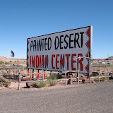
Time to move on, I started out from Williams, Arizona, at 7:00 a.m. The route was across Arizona and New Mexico on I-40. Tooling along with cruise control I came to the spectacular vista of the Painted Desert and the Petrified Forest near the edge of Arizona.
They call these red and white mounds badlands because they deteriorate so easily. I found this very amusing since I had wanted to go through the Badlands of South Dakota but decided against it because, well, I had to make some choices.
It was only about 10 a.m., so I decided to detour and explore the Petrified Forest. What a great choice! The Painted Desert is so subtly beautiful with soft greens and yellows giving off a feathery feeling. As the temperature was only in the low 60’s, it probably added to the tender vista that gently rolls out in all directions, a few mesas lifting off in the distance.
The road winds a bit around some of the red badlands then straight south about 10 miles to where the petrified wood is. Again, I’m visiting ancient history where forests once stood tall and thick, then went under water, and eventually dried up. I learned that the wood breaks down and minerals find their way in to transform trees to rock.
I had now traveled from magnificent redwood forests to forests turned into rocks. The full circle of transmutation.
Just past the border into New Mexico deep black rocks were surging up from the ground in large swaths. At first glance it looked like soil that had been freshly unearthed, but as I saw more, closer to the highway, I realized they were huge black rocks.
The road north of Albuquerque to Cuba (my brother's home) is a pathway into pleasantly spaced canyons, mesas, and buttes that were highlighted with the brilliant sunset.
Friday, November 20, 2009
The Grand Canyon Again
 |
| Day 28 Photo Album |
September 30, 2009
The morning got off to a rocky start with my computer, the Mac server, and myself colliding un-harmoniously with the end result that all the titles on my photos were lost and I have to copy them from the version on the server before I post again.
Not unlike the weather: fierce wind and cold temperatures. The wind picked up last night and some rain fell as I drove home. The forecast was for showers in the morning, so I did not try to see the sunrise at the Grand Canyon.
Today’s visit to the canyon was quite different. I prepared to be without access to my car for the day, packing up food and water, taking all my layers of clothes, rearranging all those precious bits of myself that have particular places.
The shuttle buses on the Hermit’s Trail section (the western third of the south rim) are very full due to this being the only access. But people get off at different places and we all seemed to be rather spread out along the canyon in a very comfortable way. If you are very energetic, you could walk the entire way and back, about 7 miles each way.
I started at Hopi Point and walked a mile or so in each direction from there. The views are different and in several places you can see the Colorado River and some rapids.
It was so cold and windy I had all four layers on immediately off the bus. But as I walked I found the wind was not always intense, just in the flat and open areas. This trail has quite a lot of trees beside the dirt path (another advantage from the Mather Point trail which is asphalt) and winds along the cliff quite close to the edge.
As I gazed out at this wonder, trying to take in everything, I began to see rhythms in the layers and their complex falling away formations. The graceful expressions of letting go of what seems hard but as it meets the wind, unwinds itself.
It helps me to sketch some bits of line, zooming in on the puzzle pieces, even though the edges of the paper confine the desire to keep going.
The ravens were showing off all day. Sometimes alone but frequently in pairs, diving, soaring, dancing with each other near the cliffs. Talking in casual voices. They let their legs dangle as well.
Once I am pretty sure I saw a condor, but only one.
I hopped on the bus again to the end of the line as the day wore on. The pull to watch the sunset was tempered with the cold and tiredness settling in. So I decided to savor the last moments of the canyon here at Hermit’s Rest. Shadows were growing longer and out of the corner of my eye I could almost see them moving. Somehow those moments linger with me in a quiet, familiar way.
As I rode the bus back to the parking lot I felt as if I had been to a great art exhibit and seen too much art. I was so full of this canyon in the best possible way, I couldn’t take in any more. And this feeling, these experiences are held deep inside of me, embedded in a way that I can reach inside for the rest of my life to pull out a fresh experience from those memories.
Traffic was heading into the park as I was heading out. It is heart warming to see people enjoying sunsets. A reassurance that many, many people value nature and the power of a sunset.
I was not disappointed by the drive back to Williams. The sunset was at 6:15 but the spectacle on the plains was 360 degrees for at least a half an hour and 180 degrees for another 15 minutes. All the way back! Being able to see forever in all directions creates a bowl of light overhead. On the eastern horizon shades of pink, blue, and purple hovered and shifted in balance with the dwindling intensity of light-at-the-end-of-the-tunnel-yellow along the western horizon. As the sky overhead reached for the darkest black it could find and the ground joined in that search, the western horizon continued to glow with defiance and as if to show how amazing it is.
I will sleep well and deep with a fullness of the treasures inside those canyon walls.
Sedona
 |
| Day 27 Photo Album |
September 29, 2009
Following in the footsteps of my past, I drove down to Sedona through Oak Creek Canyon, where I went in 2002. This time, I had a friend to visit. As if to flesh out a memory of 2002, the wind picked up speed last night and the canyon was as windy today as it was then.
The road is very winding and the views spectacular. At the base of the switch-backs, my friend tipped me off to a spring that gushes water out of two pipes along the side of the road. Pure water with the sweetest taste you can imagine. Loads of people were stopped to fill up their water containers. Lucky for me, I have a capacity for 7 gallons! My strength must be improving because I lifted the full container into the back seat of my car.
Downtown Sedona is highly packed with extremely expensive tourist stores and was bustling with us foreigners. It’s a great place to watch people and there are lots of places to park yourself for this pastime. I had a fudge, carmel, pecan sundae and did it justice.
The weather was hot, upper 80’s, and windy. It felt good.
My friend lives in West Sedona, backed up against a greenway. We took a hike into the hills and I was disappointed not to see any snakes or other creatures. I ate a juniper berry right off the tree and nibbled on a mesquite pod (I’m pretty sure I’m remembering that one correctly).
The redness of the earth is startling especially because of the abundance of green. The contrast vibrates with an intensity that is hard to describe. Very other-worldly. I did not see one speck of dirt that wasn’t red. Anywhere.
We took in the view to the southwest from a height, then over to a stupa, which is a meditative shrine for Buddhists. People come to pray while circling the shrine. The interior of the shrine is filled with prayers that were rolled into cylinders and sealed. It sits within a notch in the hillside and is a beautiful place to pray, meditate, or simply let your troubles go.
The sun was setting as we walked and as it came out from behind the clouds, the light looked like morning to me. It had a crispness and new-day feeling about it that surprised and delighted me.
For a real special treat, we watched the constantly changing light diminish from the roof of her house!
Another richly imbued day connecting with someone who has helped me tremendously along my path for many years.
Wednesday, November 18, 2009
The Grand Canyon
 |
| Day 26 Photo Album |
September 28, 2009
Today my car needed some care; the heat shield for the gas tank had rusted loose and was dangling. Easily repaired by the garage next door in an hour. So my start to the Grand Canyon was a bit delayed.
I left at noon and decided to stay for the sunset. The park is 54 miles from Williams and it never closes. If you arrive during the gate hours you have to pay, but the pass is good for 7 days. In spite of the crowds and lack of parking due to construction, I got a great spot right at Mather Point.
The glory of the canyon is not diminished by having seen it before, nor the middle of the day. I walked a mile and a half along the rim trail enjoying every minute. The further you walk from the parking, the fewer people are on the trail. Remembering advice to watch where you sit before you sit (that is, to avoid scorpions, snakes and the like), I rested some on the rocks along the way. The temperature was about 85 and there were some scattered clouds, casting deep shadows into the depths. Shuttle buses stop every 15 minutes at designated areas, making it very convenient to get around without using the car.
I had lots of time to spare before sunset, so I had some lunch in the cafeteria and watched the commotion of employees and people. There are many nationalities visiting and working in the park.
I decided to go to Yavapai Point to watch the sunset. Apparently Hopi Point is the favored spot, but you have to take the shuttle through that area and I couldn’t find a spot near the shuttle. Loads of people are just as interested in the sunset as I am!
Though the wind had not been blowing before, it started up rather strongly as we all edged around the edges. The funny thing about the park is listening to people scold their loved ones for getting too close to the edges for pictures.
I finally settled down on a ledge once removed from the final edge and snapped away as the sun came out from the clouds then sunk behind the horizon. It was wonderful to be there with so many people who were like excited children, happily anticipating the show. Sharing a magnificence that defies words or photos.
Photos can’t compare to the experience, but I may have enough saturation to get a few paintings out of it some day. It is as if the breath of eternity silently pulses, penetrating all matter. The longer I am there, the less I need to look. I can close my eyes and feel the inside of the universe.
Tuesday, November 17, 2009
Williams, Arizona
 |
| Day 25 Photo Album |
September 27, 2009
The drive from Kingman to Williams is a fun 100 some miles. The landscape changes from next to nothing to yellow plants carpeting the plains dotted with cotton ball shaped trees. Interesting shapes. There is a healthy color and freshness to them.
Though it doesn’t seem to be rising in elevation, my car struggles to keep up speed without some extra pressure on the gas pedal, reminding me that the land is rising.
The trees begin to get higher and take a more traditional shape as a small pointed mountain nears. Soon the hills are covered with trees. I especially enjoy seeing that lone mountain out in the distance and being drawn into it, over it and beyond it.
Stopping in Seligman for a break, I treat myself to an A&W root beer float in the 97 degree heat. Perfect in the shade, but a bit toasty in the direct sun. I’m on Historic Route 66, aka I-40. The businesses along this route have everything you can think of with Route 66 on it.
Williams is a nice little tourist town that I’ve stayed in before, back in 2002 when I visited the Grand Canyon the first time. It is 60 miles south of the Grand Canyon and has very reasonably priced motels. I could camp here too, but I decided that I shouldn’t since I haven’t educated myself about how to deal with rattle snakes, scorpions, and other creatures of this land. Most likely I would be fine, but some doubt is knocking on my brain.
I found the motel we stayed in after driving around town a few times. Age and loss has worn the owner down a bit, but is still quite friendly. Little has changed in the motel, which is comforting. The town has grown somewhat with more tourist dependent places: restaurants, gift shops, jeep rides through the canyon, clothing stores, Route 66 themed shops, and more motels.
It feels good to be back here. I have fond memories of that trip and intend to stay here a few days. The shock of not moving constantly is something to adjust to. All my thoughts seem to have dwindled in the desert. Who am I? What am I doing here? Where am I going? The answers can wait, I go to Safeway and buy some much needed food.
Monday, November 16, 2009
Death Valley
 |
| Day 24 Photo Album |
September 26, 2009
In a burst of energy after a restful night, I shed my morning ablutions and even coffee to set out by 7:30 am from Lake Isabella. The morning light on the mountains was spectacular. It made me realize that if I lived in this part of the country I’d sleep from 11 am to 5 pm and enjoy the sunrise and sunset with the deep night sky.
After the sun sets the temperature drops down to 50 or so and it takes a few hours to get really hot after it rises. I feel absolutely fantastic here, even in the middle of the day at 105 degrees. I’m beginning to think I’ve become too water logged over the years.
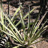
The drive over Walker Pass is winding, but rather gently so, and beautiful. New kinds of trees, Joshua, that look like cartoons waving and flaying their arms about, saturate the Pass. The geology is ever changing and many different colors, from black to white.
For the first time in many, many days, my creativity seemed to open out and experience the landscape in the expansive way I’m familiar with. I was happier than I’ve been in ages. Walker Pass was the doorway to an even greater sense of peace I discovered in Death Valley.
My route was 178 east onto 395 north then 190 east. Most of this is through mountains with the elevation rising and falling from sea level to over 5,000 feet. They’re called mountains, but it feels more like canyons married to above timberline with a touch of just plain scrubby hills.
The mountains jut upwards with revelations of their past, their varied layers, hidden secrets bared for all to see. Huge mounds of loose dirt cascade down to the road in a solid color as if to say, “nothing is solid.”
I enjoyed imagining that I was driving at the bottom of the sea. Here, in this space, the water used to hide these amazing mountains. Those wing-shaped rocks I just saw in the Pacific Ocean had foundations like this. I was swimming in my car.
Stovepipe Wells is nearly at the end of the park and at one point before leaving I had considered staying there. It is at sea level and in the wide open spaces around the sand dunes. Now that I’ve seen it, I just may do that some day. There was too little time to see too much. But what I did see was great and in terms of landscape, my all-time favorite so far.
Crossing into Nevada there is one more pass to traverse, Daylight Pass, through the Amargosa Range. I could have turned south on 190 and stayed in Death Valley, but didn’t. I got to Beatty, Nevada, around 1:30 pm and decided not to stay there but to push myself as far south as I could go. I’m heading for Williams, Arizona, to spend a few days at the Grand Canyon. (Williams has really cheap motel rooms.)
Passing through Indian Springs is a peculiar experience. While taking a rest and eating some ice cream, I put a dollar in the slot machine and played poker, leaving with my dollar in tact. There is a military outpost there and lots and lots of vehicles that are odd. Wires, power sources, gates, fences, “no” signs everywhere (as my brother calls them).
As soon as I left Beatty, the road becomes a straight line forever. Okay, a slight jog here and there. Las Vegas and surroundings break things up with its huge sprawl. At Boulder City, just outside of Hoover Dam, I contemplated staying overnight to spend a bit of time at the Dam in the morning. But their motels were too expensive and I still had a bit of juice, so I kept going.
Hoover Dam has security checkpoints before you can enter. My car is loaded to the gills with so much stuff there is no available space, even on the front seat. But he gave me and my car a look and said, “to the left, have a nice evening!” Tons and tons of people walking around the dam and the parking lots were not even full. It is really an awesome feeling driving through it. Such rugged mountains and all the immense structures hovering over the cliffs. The things we do are pretty remarkable.
That being my last exciting encounter, I put the car back in cruise control and drifted on into the sunset. As I watched the landscape I became aware of a familiarity: this is the edge of Grand Canyon territory and it looks like it. More plains between mountains and the rocks take on a more consistent red tone.
As the sun set I found myself in Kingman, Arizona, and a low priced motel available. It’s clean, huge, and has lots of plugs. One thing that I’ve noticed in my motel stays so far is that they don’t give you many plugs.
I’m tired but very glad I made it this far today. My plan is to settle in Williams for a few days and spend some time at the Grand Canyon and Sedona.
Sunday, November 15, 2009
From Fog to Lake Isabella
 |
| Day 23 Photo Album |
September 25, 2009
After a very slow start and pondering whether to stay put for a day, I chose to head for Lake Isabella and camp, perhaps stay there longer.
I wanted to drive through San Luis Obispo, about 38 miles away and then head east for the long trek home. While the sun had begun to shine in Cambria, it was quickly gone down the road as fog crawled across the land. There are so many beach access points along Route 1 and I was tempted to stop again and again, but it was time to go.
After a few wrong turns in San Luis Obispo, I got to see various areas of the town. It has a nice feeling to it. A college town at the base of some interesting hills with quite a lot of trees. It’s busy in a nice way.
Heading out of town you immediately begin to climb up the hills, or mountains. The landscape changes rapidly from barren land to scrubby land to vineyards. The road is winding and surprising from turn to turn. The fog was gone and the temperature was climbing from the low 60’s I left in Cambria to the upper 90’s. I began to feel much better as I got further inland and the sun baked away all the dampness.
It was a very interesting journey through nowhere and not much else. Very few cars and seemingly deserted space. Yet there are ranches, farms, and vineyards scattered along the way. There are no towns where you could stop and get water or use the “services” (as the highway signs call gas, food, and lodging) between San Luis Obispo and Bakersfield on Route 178 which is about 125 miles. About half of the road curves in and out of hills and valleys, then the land is open and the road either flat or has a series of really fun dips, like a mini roller coaster. Nearing Buttonwillow the land becomes winding again but is featureless except for the oil drills and surreal buildings of the production of oil. I believe this is Chevron country as I saw their sign at one point.
Surrealism becomes even more apparent as you drive through Buttonwillow and into Bakersfield. Forests of power lines, generators, etc share space with orchards. There is nothing here except industrial buildings scattered about. Then the farmland begins to fill the spaces and Bakersfield crowds around.
Just on the other side of Bakersfield is the Kern River Canyon that leads up to Lake Isabella and Walker Pass. This is rock country. Mountains of Rocks. I felt like I was in the high country of Colorado above timberline. Huge mountains of rocks. The road winds quite a lot and is narrow, but I found a turnoff or two to get some photos.
At the top of the pass is Lake Isabella, which looks like it has dried up quite a lot. I was hoping for more trees, but just because the map has green bits on it, doesn’t mean you’re going to get trees or vegetation!
Thankfully, the KOA campground had some trees and a view of more on the north side. The temperature had stayed over 100 all the way through the day and was just falling to the upper 90’s. It was hot, but not unbearable. I was happy to have my tent up again and looking forward to sleeping on the ground.
Saturday, November 14, 2009
The Long and Winding Road
 |
| Day 22 Photo Album |
September 24, 2009
It was a cold and foggy day with few breaks in the icy fingers of water-that-can’t-decide-what-it-is-so-it-just-searches. I walked along Fisherman’s Wharf in Monterey with terrific wind. The sun was shining then and it was pleasant. I had breakfast downtown at a place voted the best breakfast place in town. Scrambled eggs with artichoke hearts and salsa. I was informed by a woman I met in the redwoods up north who grew up in Monterey that when I came here I should check out Castroville, which is the artichoke capital. It is north of Monterey. This will be as close as I get.
Heavy fog settled in for the next few hours making it difficult to see much around the Monterey Peninsula. It is “thickly settled” as the signs say back East. This means there are lots of houses close together.
In a place where there are very wealthy people, there are always very poor people to do the work. This caught my attention because the openness I had experienced up north was quickly disappearing. While the area is very nice, the vibes were as insidious as the fog.
So I left. Heading south to San Luis Obispo. The fog was so dense at one point I had near zero visibility along Highway 1’s constant twists and turns. Then around Big Sur, the fierce wind stopped and the sun came out. I toured a campground and was tempted to stay there, even though it was only 2 pm. But an urge to keep moving and the beginnings of a desire to go home prevented me from one last night in the redwoods.
Big Sur is a great place. It looks like all the other mountains and valleys I’ve been through, but there’s something else going on there that makes me happy. I’ve decided I need to go back there some day and spend quality time.
At the Post Office in Big Sur I met a man who hang-glides, using the steep cliffs and strong winds to fly. He explained that the fog is seasonal and they’ll get more of it in November, but right now, they’re in the sun. (His blog with videos of flying is: bigsurpete.blogspot.com. Worth a look as the camera is positioned up and behind him at an angle that allows you to see and feel the experience from the safety of your chair.)
This is what I like so much about Californians: these extreme elements are just tools for them to have a great time in nature.
As both my sister and Peter Rosen, aka Big Sur Pete, recommended I check out Cambria, that’s where I am. There is a town next to Cambria called Harmony with a population of 18. All artists. The town is really small and has many tourist-dependent shops. It is inland just a short distance. I bought the local paper and it is the most unusual shape I’ve ever seen: about 14” x 14” and opens like a book.
I’m tired and even more tired thinking of driving all the way home, so a nice clean hotel in an ideal spot is a great comfort. Tomorrow will wait.
Friday, November 13, 2009
Santa Rosa to Monterey Peninsula
 |
| Day 21 Photo Album |
September 23, 2009
Santa Rosa and I got off to a rocky start. After the insidious fog I found myself in the unfamiliar constant noise of traffic, machines, and strip malls. Ice machines rattling all night, refrigerator and microwave happily vibrating with irritating hums. The usual noises of life that seemed to supplant the annoyance I had begun to feel about fog.
But we became friends this morning as I ventured into downtown and walked around to explore. It is a lovely city and I really enjoyed walking around. Pretty quiet for 11 am. The art center I visited had some very good work and there seemed to be quite a lot of activities involving the arts.
My next stop was Muir Woods National Monument which is extremely popular. Signs show that weekends are so busy there are shuttle buses from Highway 101 to the park. After leaving the highway you wind your way through the mountains down into the park. It is so large there are about 65 miles of hiking trails. I settled for 3 miles of walking.
I find it very interesting that when I arrive at a busy park I weave through with a small group of the same people. They pass you, you pass them, you have small talk and walk on. Take their pictures for them, see them in the gift shop, the bathroom, then out to the parking lot.
This park had more city people who have the need to talk constantly. In the redwoods park up north, people were more quiet and absorbing the experience. They actually have a sign in the Muir Woods at a grove called the Cathedral Grove asking people to be quiet and listen to nature. Ignored by most of the strollers.
It was a great experience all the same. Quite different in that the trees were spaced more thinly and are not as wide as those up north. The rising hills within the park also add a different feeling to the forest.
Back out on the highway I went over the Golden Gate Bridge in partial fog, but got great photos all the same. In San Francisco it was completely foggy. I immediately loved the city. It was tempting to stay a while, but I had decided to press on to Monterey today. I took the Presidio turn and had no idea where I was headed, but it was nice. Then I looked at my compass and thought I should turn more south. Found Highway 1 and stuck to it all the way down to Seaside.
Along the coast again, the fog came and went. The temperature had dropped down to 60 again and stayed there. This section of the highway is very straight and there are many farms along the road. Beaches everywhere. Spectacular views all day long.
At Big Basin Redwoods Park I saw several kite surfers and stopped to get their photo. What a blast they were having!
Just after sunset I reached Seaside in the Monterey area. So I’ll be on my way to exploring the Monterey Peninsula tomorrow and see what that’s all about.
I’ve finally arrived at my intended destination. There is a good feeling about that, as if I’d been waiting for this since I got to California.
Thursday, November 12, 2009
Highway 1
 |
| Day 20 Photo Album |
September 22, 2009
Insidious fog. I like cool weather and fog. Winding roads and changing landscape. But I learned one important thing about fog today: enough already. It creeps into your bones and hovers in your mind.
Today’s drive was fascinating in that the scenery was extremely beautiful and constantly changing from sheer cliffs to wide tops of cliffs (not sure if that means it’s a butte, but I don’t think so) to interlocking mountains (or steep hills). All in fog and low 60’s temperature.
The morning began spectacularly around 5:30 am. The sky was pitch black with more stars than I’ve seen in a long time. I could vaguely see the Milky Way across the sky. Crystal clear sky. Stars from horizon to horizon. By a little after 6 am the curtain of fog began to infiltrate out of nowhere as the sun lightened the sky. In the right light I could see a spray of moisture glistening in the sunlight. The sun was shining and the upper sky blue, but fog crawls across the land without fail everywhere. All day.
It is a drive that really requires two people to change off the driving so one person can enjoy the views. Otherwise, you need to stop quite a lot and some of the best views are in places that you cannot stop. Those fleeting seconds of dramatic compositions. I would guess that the bicyclists have the best time of it, though they must get very tired. I saw many people with loaded bicycles all day.
I followed Highway 1 all the way down to Bodega Bay from Westport. I would say my favorite town was Fort Bragg. It seemed like a great place. I stopped in Medocino for a bit but was less interested in it. There was a feeling of Rockport about it. In Point Arena I stopped for some cheese and when I asked the local woman in the shop if it was always this cold, she said “this is Point Arena.” Okay. As I passed through all the towns it was very clear they were vacation spots. State parks and beaches are everywhere and people were taking advantage of them.
Turning east towards Santa Rosa on Route 12 I watched the temperature climb from 60 to 85 in about 10 minutes. The sun shone sans fog and I was happy for that. Passing through Sebastopol I felt it was the kind of town I’d like to explore, but my destination was Santa Rosa and the sun was sinking, so I passed.
Taking a few wrong turns, sort of on a whim, I skirted the western edges of Santa Rosa and found that it is very spread out and has many agricultural areas as well as ranches and the like. Very flat. Eventually, I found my way to the cheapest motel in town sandwiched between Hwy 101 and the busiest street through the city. A bit of a jolt after such a quiet day. But I wanted a transition stop before heading into San Francisco and beyond.
Wednesday, November 11, 2009
Deep Time
 |
| Day 19 Photo Album |
September 21, 2009
Waking in the heart of the Redwood forest is a great feeling. Though I can hear the highway when outside, it seems very far away. This little town of Redcrest has a population of 112 and an elevation of some 300 feet. Redwoods stand around the grounds like beings beyond worry, oh so far beyond even thinking. They seem to absorb everything around without being bothered by it in the least. I didn’t intend to be back here in the forest, but am very glad it worked out that way. I think I have something to learn from these trees and as I read the materials about the redwoods, I believe I may spend some more time walking among them today. Going beyond the word mystery I found myself describing the feeling here as deep time. I feel held here. In stillness and deep time.
This “resort” is the kind of place I’ve driven by so many times while traveling and wondered what it would be like to stay. The use of the word resort is interesting. It must be a category that is used in the hotel industry to denote some additional features. This is far from the modern resorts with sanitized entertainment. It’s just some buildings linked together in the woods and outfitted like a motel, but there are picnic tables and grills and you’re nestled in the woods.
I took my good old time getting out and headed south on The Avenue of the Giants again. I stopped in the Founders Grove to see the largest trees in the forest. The tallest has fallen over, and then I think they found another tree even taller. Regardless of these points, it is simply a moving experience to wander among them. Everyone moves as though in a cathedral and speaks with soft tones.
The heat in the forest was about 60 to 65 through mid-day. As I headed south to around Miranda, the temperature was up to 85. It continued to climb to 102 as I got south. Pretty darn hot in the direct sun, but in the shade, no problem.
At the junction before Legget I turned west and drove the winding road to the coast. The temperature had quickly descended to 60 as I headed west. On the map it looks like about 20 straight miles, but it is actually about 45 miles or more. I loved it. Short curving turns up and down in dense forest. No peeking or taking hands off the wheel allowed. When I was getting sort of tired, the ocean suddenly appeared in front of me just beyond the high cliff.
The air was fresh and the ocean was roaring. There are many areas to pull over and take the view from high above. Pointy rocks jutting out of the water and a few sandy beaches tucked into the rocky cliffs.
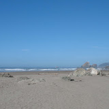
As I went south I was longing to stay near this coast. There were a few public camping sites right off the road, but it looked too exposed to both the elements and the highway. Then low and behold I turned a corner and found a KOA that isn’t in the directory! It has sites about an eighth of a mile from a very long beach, perhaps two miles, though you can camp right on the beach if you like. I’m neatly tucked into a site with hedges surrounding me and the bathrooms very close by.
A long walk on the beach was the strangest thing. It isn’t like the Atlantic beach at all. There are huge masses of dead sea plants that look like twisted snakes with bulbous heads. The ocean is more forceful than Crane Beach (which is admittedly rather tame). The cliffs rise up in wonderful formations and the rocks in the ocean are very pointy, like wings caught in mid-flight.
The temperature is quite cool here. It was about 65 when I arrived around 4 or 4:30 and quickly fell as the sun went down. Still, I’m bundled up in my tent and just fine.
Odd, isn’t it? Sitting in a tent with internet connection and all this electronic stuff!
Tuesday, November 10, 2009
Humboldt County Coastline
 |
| Day 18 Photo Album |
September 20, 2009
Not feeling entirely enthused about Eureka, I avoided it until the afternoon. The day began extremely overcast and 60 degrees. But that doesn’t dampen the disposition of the inhabitants around here. They are cheerful and friendly.
While touring around Arcata, a very small town, I encountered many streets blocked off -- apparently there is something going on later today. So I set off for a few places north of Eureka that were recommended by some Texans I met in the forest yesterday.
First stop was Moonstone Beach. This is the beach I saw yesterday with all the rocks jutting out of the ocean. The tide was about in the middle or rising, my best guess. I saw my first group of surfers, though they never got onto their feet. They seemed to just bob around in the ocean.
Further north is Patrick’s Point State Park in Trinidad. This gave me a very good idea of the near impossibility of camping in the state parks in California. The gatekeeper was extremely friendly and harried. The campers were sort of getting him flustered. He said the campgrounds were all filled up, very common in the State Parks.
I hiked down to Mussel Rock and found the trail full of ferns and steep stairs. It was worth the climb back up to see the waves crashing against the rocks. My next stop in the park was Patrick’s Point or Wedding Rock, maybe I could see both. You can hike out onto Wedding Rock, but I passed. Further on I stopped at Palmer’s Point where I could hear the sea lions barking out on the rocks. I could only see the specks of their bodies far away, but could hear them very well.
The temperature had still not reached 65 degrees and it was early afternoon. The sky finally cleared off about 11:30 in the morning, so the sun was brilliant and making a nice slightly foggy atmosphere.
I was going to head for some town further south when I chose to take a peek at Eureka’s downtown. I was pleasantly surprised by the area. The town is very spread out and mostly featureless, but the downtown area of about 5 blocks is in the mode of “old-town” as they call it. Better yet, I found two great natural grocery stores to get fresh fruit.
In forced spontaneous mode, I headed south with a few spots in my head that I may or may not explore.
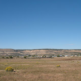
Ferndale caught my attention so I left the Hwy 101 towards the coast 5 miles to this Victorian town. It really is quaint. I walked along the streets and spoke to one of the shop owners. She says they have no crime or derelicts (there were several in Eureka -- and she noted they have their share). It is farm country, but mostly dairy. Also in the Tsunami Hazard Zone. They have a huge tourist trade as well. The beach is another 5 miles from town and I got the tip to go beyond the lower parking lot to the top of the winding hill. Sure enough, the view from there was spectacular. This is The Lost Coast. It stretches way out of sight to the north and at the base under the cliffs is a small valley with a ranch nestled in it.
The sun was beginning to get low in the sky, so I thought I’d push on to Leggett where 101 meets 1. Unfortunately, I hit the wall and the sun was nearly hitting the horizon when I had to stop. Redcrest ushered me off the highway and into the coziest little spot where I have a very nice room in the middle of the redwood forest, on the Avenue of the Giants!
Monday, November 9, 2009
Avenue of the Giants
 |
| Day 17 Photo Album |
September 19, 2009
The day began with a perfectly still Clear Lake morning. The light is beautiful and the air clear and warm.
I followed Highway 29, 20, and 101 through very little traffic and beautiful landscape. The land unfolds and folds up again and again; widening with sparse trees and dried grasses, closing with spikey, thick forests along winding roads. The lanes on the highways do the same thing: first a two lane road, then a divided road, then back again.
There are many places to pull over along the whole stretch from Lakeport to Eureka. This is a great pleasure if you feel like stopping or letting traffic by. Freedom.
After an hour or so I found myself being offered the choice to parallel 101 through the Avenue of the Giants. It is a winding road through the Humboldt Redwoods State Park with many stopping places to walk on trails or camp or just pull over. I made it to the middle of the forest before taking my walk and eating my lunch under the trees. They are truly magnificent. It is very dark in the forest and the flash on the camera wants to come on, so I let it. You really have to bend your head back to see the tops. Sitting on a bench helps.
One of the funniest things I noticed is that they produce the tiniest pine cones, just about the size of a thumbnail. They also hail feathery bits they don’t need anymore. As I sat there, I got hit by a variety of odds and ends from above.
It is a very interesting experience. I’m not especially a forest type. I prefer open spaces and light. Yet I did enjoy the solemnity of the forest. A bit more light would suit me, but it might take away some of the mystery.
As I came out of the forest I encountered heavy clouds and much cooler weather, about 65 degrees near Eureka. The landscape changes very quickly to completely flattened out coast. I’ll reserve any opinion about Eureka until tomorrow as I only passed it on the highway and was unimpressed.
In order to see the actual Pacific Ocean I had to go north about 10 miles to McKinleyville. It was sunset and I spotted some interesting rock formations in the water a bit north. I’ll investigate those tomorrow.
A strange feeling has settled on me as I reached the other end of the continent. I’m finally at the end. I did it. I drove all the way across the country. An evening of reflection, perhaps even a day of reflection seems to be in order. I’m relaxed, happy, comfortable, have no desire to go home, and have no particular affinity with this location.
Every place I’ve been through is uniquely itself. California’s vineyards may look like Tuscany in pictures, but there’s not a shred of that feeling in real life. California is just California. Now I’ll spend some time finding out how that changes as I go south down the coast to Monterey.
Sunday, November 8, 2009
On the Road to Lakeport, California
 |
| Day 16 Photo Album |
September 18, 2009
My day began brilliant and ready for the long trek through California. The forecast was predicted to be in the 90’s. In reality it turned out to be 103 at the highest and remained above 100 most of the day.
As soon as I hit the California side of Tahoe I encountered major traffic delay due to construction. Unlike the middle states, when the signs say the right lane is closed ahead, people continue to drive in both lanes and crowd in at the very end. Ah well, just like back home.
The construction went all the way up Donner Pass and over the top. The temperature had climbed up into the 90’s as well by late morning. Stopping near the end of the western slope of the pass I couldn’t believe how easily I was able to walk around in the heat. This is my brother's old stomping grounds, so we had a talk about where I might be.
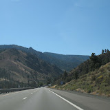
As my brother predicted, I was nearing civilization soon and with it, heavy traffic and higher heat. Still, I was enjoying the landscape and having fun taking very bad pictures without looking. What a surprise to see cypress trees! I couldn’t help look at all the beautiful dried grasses and think of them as fuels for fire. The contrast of yellow-orange grasses and lines of trees is unique and yet vaguely similar to Tuscany. Truthfully, I didn’t feel any Tuscan sensibility. Perhaps if there weren’t so many cars zooming around it might feel differently.
I turned off in Vacaville to see if I could find a route into Napa Valley but failed. So I got back on the highway and off again at Napa. I followed Highway 29 through Napa Valley with bumper to bumper traffic coming in the opposite direction for many, many miles. It began to thin out around Yountville so I got off and stopped in a park to eat around 3 pm. My goal was to reach Willits and camp, but I couldn’t get through to the KOA, so I just decided to keep going and see how things developed.
While the landscape is beautiful through Napa Valley, I was getting tired of all the traffic and didn’t really feel inclined to stop at any of the huge wineries. I set my sights on Clear Lake and hoped to reach a camp ground there before dark.
After the town of Calistoga, the traffic disappeared and the ride got very pleasant. It climbs up and over a mountain so the twists and turns keep your speed at 30 (my speed anyway, there were many cars that passed when the road allowed it). Now I began to feel very happy with the drive. All those days in the desert make traffic a bit of a jolt!
I finally hit the wall around Lakeport and found a reasonably priced hotel right on the lake. There is no one here really, just a few people. The grounds are lovely and there are docks and a boardwalk along the lake. I had about a half an hour to enjoy a stroll and watch the sunset.
Saturday, November 7, 2009
Reno and Virginia City
 |
| Day 15 Photo Album |
September 17, 2009
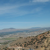
Just over the mountain from Reno, about 15 miles away, is Virginia City. The ride over the mountain is winding and offers great views. For those who watch Bonanza, this is the town featured in that series. It is built on a hill and has a wonderful view down into the valleys to the east.
I put my dime in the slot machine and won 75 cents. In the course of 15 minutes I had a net profit of $1. So I stopped.
Another wonderful evening with my aunt and uncle in the peaceful wide open spaces was a great pleasure. Their knowledge of the California areas I wanted to visit was a great help in making a decision about where to go. There are so many things to see in California that I just couldn’t make up my mind which way to go! What to see!
Thanks to my family, I’ve made a decision to head north to Eureka before going to Monterey. I’ll wind my way through Napa Valley and around Clear Lake.
Subscribe to:
Posts (Atom)