 |
| Day 23 Photo Album |
September 25, 2009
After a very slow start and pondering whether to stay put for a day, I chose to head for Lake Isabella and camp, perhaps stay there longer.
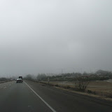
I wanted to drive through San Luis Obispo, about 38 miles away and then head east for the long trek home. While the sun had begun to shine in Cambria, it was quickly gone down the road as fog crawled across the land. There are so many beach access points along Route 1 and I was tempted to stop again and again, but it was time to go.
After a few wrong turns in San Luis Obispo, I got to see various areas of the town. It has a nice feeling to it. A college town at the base of some interesting hills with quite a lot of trees. It’s busy in a nice way.
Heading out of town you immediately begin to climb up the hills, or mountains. The landscape changes rapidly from barren land to scrubby land to vineyards. The road is winding and surprising from turn to turn. The fog was gone and the temperature was climbing from the low 60’s I left in Cambria to the upper 90’s. I began to feel much better as I got further inland and the sun baked away all the dampness.
It was a very interesting journey through nowhere and not much else. Very few cars and seemingly deserted space. Yet there are ranches, farms, and vineyards scattered along the way. There are no towns where you could stop and get water or use the “services” (as the highway signs call gas, food, and lodging) between San Luis Obispo and Bakersfield on Route 178 which is about 125 miles. About half of the road curves in and out of hills and valleys, then the land is open and the road either flat or has a series of really fun dips, like a mini roller coaster. Nearing Buttonwillow the land becomes winding again but is featureless except for the oil drills and surreal buildings of the production of oil. I believe this is Chevron country as I saw their sign at one point.
Surrealism becomes even more apparent as you drive through Buttonwillow and into Bakersfield. Forests of power lines, generators, etc share space with orchards. There is nothing here except industrial buildings scattered about. Then the farmland begins to fill the spaces and Bakersfield crowds around.
Just on the other side of Bakersfield is the Kern River Canyon that leads up to Lake Isabella and Walker Pass. This is rock country. Mountains of Rocks. I felt like I was in the high country of Colorado above timberline. Huge mountains of rocks. The road winds quite a lot and is narrow, but I found a turnoff or two to get some photos.
At the top of the pass is Lake Isabella, which looks like it has dried up quite a lot. I was hoping for more trees, but just because the map has green bits on it, doesn’t mean you’re going to get trees or vegetation!
Thankfully, the KOA campground had some trees and a view of more on the north side. The temperature had stayed over 100 all the way through the day and was just falling to the upper 90’s. It was hot, but not unbearable. I was happy to have my tent up again and looking forward to sleeping on the ground.
No comments:
Post a Comment
All comments are reviewed before publication. Please allow for a short delay.
If you don't see a message saying "Your comment will be visible after approval." then it didn't go through.
Try a different browser or send me your comment via e-mail.